Projects
NOS Sensorweb
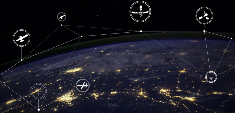
Image from ESTO AIST https://esto.nasa.gov/nos-workshop/
Background
The advancement of remote and in-situ sensing technology, combined with the emergence of New Space ventures, is producing a variety of new measurements for Earth Science phenomena. New observation techniques must combine and leverage these federated systems. In developing this new paradigm, NASA’s Earth Science Technology Office is developing the New Observing Strategies (NOS) Testbed to validate and demonstrate new operations concepts. As a part of this effort, we have developed a planning and scheduling system to support automated retasking.
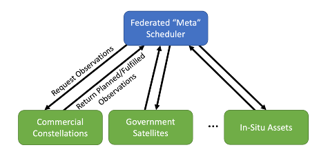
Networks of remote and in-situ sensors can be combined into sensorwebs to more accurately monitor environmental phenomena. Science models can be used to identify or predict events of interest, such as flooding or volcanic activity, which can be used to trigger additional observations by target-able and adaptive sensors. As part of this effort, we developed the planning node for NOS – a scheduling system to support a federated scheduling system, creating schedules for spacecraft controlled by other organizations, and requesting observations from external assets based on this schedule. Generated data products can be then fed back into the model, improving future forecasts.
Technology
We have developed several new technologies as part of this initiative.
We have created several scheduling algorithms for efficiently distributing scheduling tasks across a fleet of satellites (Boerkoel et al IWPSS 2021). Our approach is to treat constituent scheduling problems, e.g., the imaging of a single satellite, as loosely-coupled subproblems, solving them independently but employing various heuristics for communicating how the solution to one subproblem might influence the others.
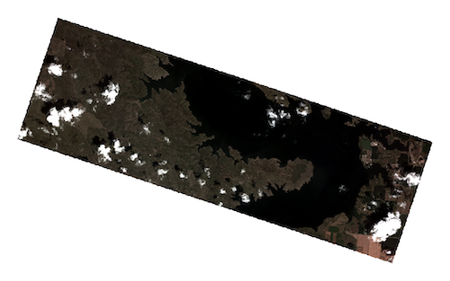
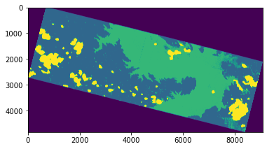
Automatic data processing is sometimes required, and depends on the asset and the target phenomena. We implemented an analytic classifier that derives surface water extent from Planet imagery (based on Cooley et al. 2017, Remote Sensing).
We also consider the federated nature of the problem: distributing tasking requests to third parties based upon their availability. We have demonstrated on several simulated and synthetic datasets and also have operational tasking integrations with both Planet’s Skysat constellation and Capella Space’s SAR constellation.
Impact
This effort has created a completely autonomous system for identifying and observing each science phenomena. The testbed is being used to prototype new tasking strategies related to the sensorweb concept.
Status
We have demonstrated this work with a next generation JPL Volcano Sensorweb (VSW). The VSW is operational, and autonomously submits tasking requests to Planet to image volcanoes of interest.
We have also demonstrated the technology in a demonstration using historical data, based on a hydrology use case. It was constructed as a data denial experiment to measure potential impact. We are currently working on a live demonstration.
Publications
Team
Steve ChienJames Mason
Jason Swope
Alberto Candela
Itai Zilberstein
James Boerkoel (Harvey Mudd College)